If you have been using the traditional traceroute tool of Windows or any other platform, then it’s time to change that. Although the traditional way shows the location of hops, the disadvantage is that you cannot see the Geolocation. Another thing which makes traceroute boring is the command-line interface. Now, it time to try something more advanced and useful. Today I will tell you about a free visual traceroute software for PC to trace geographical location of hops. The software which I will use here is known as Open Visual Traceroute and it is a cross-platform software. You can use it hassle-free on Windows, MAC, and Linux. However, in this article, I will use the Linux platform to demonstrate this visual traceroute software. This software takes the traceroute to a whole new level by showing the graphical location of the hops on a globe.
Open Visual Traceroute is a very powerful software traceroute software ever made. The software traces the path to each hop between source and destination and plots the path on the globe in real-time. As it finds the path to the new hop, it shows its location on the globe and in the same manner, it plots the whole path on the globe from source to destination in a typical traceroute operation. Apart from that, it makes the list of all the hops on its interface that you can export as CSV file. In addition to that, if you want you can use 3D visualization as well as 2D visualization to see the Geo location of the hops.
How to use Open Visual Traceroute to Trace Geographical Location of Hops?
Doing visual traceroute to a particular host is very simple using Open Visual Traceroute. The software works like any other traceroute software. The only difference is that you will see the geographical location of each host on the map. This will let you understand how actually a connection to a website, host is established between your end and the actual server. Also, you will not able to do traceroute only, but you can also use other tools. The software also supports Whois and Sniffing. You can capture network packets and do whatever you want.
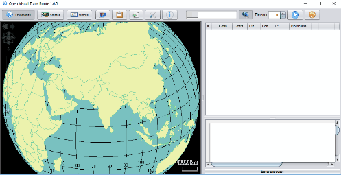
So, now let’s see how you’ll start using this visual traceroute software. First of all, make sure you have downloaded Open Visual Traceroute from its official website. After that, run it and you should see its interface. However, prior to running the software, you will need Java to run this software. Please install Java before installing the software.
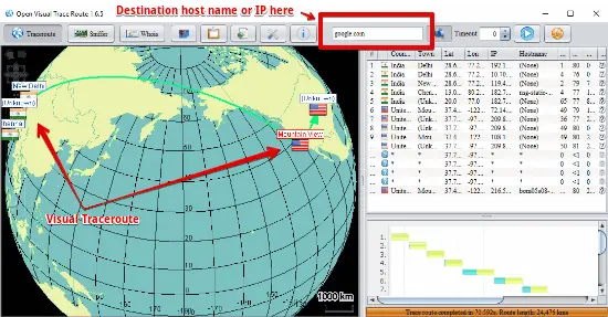
Now after you have the interface of the software in front of you, you can enter the host name or IP address of the destination for which you want to do the traceroute. Next, hit the Enter key and the software will start tracing the route. You will see the traced route on its interface and list of all the hops on the right side of the software.

In the same way, you can easily traceroute any host using Open Visual Traceroute software. The software works perfectly and plots the location of each intermediate hop on the map.
Bottom Lines:
Open Visual Traceroute software brings a whole new concept of doing traceroute. And I am really amazed at the fact that I can actually see the location of the hops on the map for the better understanding of how traceroute works. In addition to that, the software can also do other functions which I have already mentioned above. So, if you are in a network related field, then I will suggest you have a look on Open Visual Traceroute and see the graphical traceroute in real-time.


